
After the 1949 Communist revolution, Hulunbuir was annexed into Inner Mongolia, but the region kept economic ties to the rest of the northeast via the Chinese Eastern Railway.[4] During the Cultural Revolution, the parts of historical Manchuria inside Inner Mongolia were briefly restored to their original provinces; Hulunbuir was given back to Heilongjiang from 1969 to 1979.[4] Until October 10, 2001, Hulunbuir was administered as a League. The area is 263,953 km2 (101,913 sq mi) and had a population of 2.710 million in 2004, The jurisdiction area of the city is larger than all but 8 Chinese province-level divisions (and 42 U.S. states), although the actual urban agglomeration is just a very small part of the region, and the average population density of the area is very low.
Mudanjiang 牡丹江
It was called Botankou under Japanese occupation. It serves as a regional transport hub with a railway junction and an international airport connecting with several major Chinese cities as well as Seoul of South Korea. Mudanjiang is located 248 km (154 mi) from Vladivostok, Russia.
Its population is 2,798,723 at the 2010 census whom 965,154 live in the built-up area made of 4 urban districts.[1] In 2007, the city is named China’s top ten livable cities by Chinese Cities Brand Value Report
Google Maps
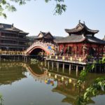
Jinhua 金华
Jinhua is a prefecture-level city in central Zhejiang province in eastern China. It borders the provincial capital of Hangzhou to the northwest, Quzhou to the southwest, Lishui to the south, Taizhou to the east, and Shaoxing to the northeast. Its population is about 5,361,572.
Jinhua enjoys convenient transportation, being the communications center in Southeast China between coastal and inland areas, and one of the major hubs of landway transportation in the country.
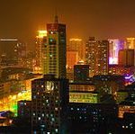
Baotou 包头
Baotou is the largest industrial city in the Inner Mongolia Autonomous Region of northern China. Governed as aprefecture-level city, its built-up (or metro) area made up of 5 urban districts is home to 2,070,801 inhabitants with a total population The city’s Mongolian name means “place with deer“.
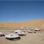
The Mausoleum of Genghis Khan, 185 km (115 miles) south of Baotou City.The best way to experience Mongolian traditional customs is to ride a camel in the vast desert or grassland, visit or live in the Mongolian yurts, drink a bowl of hot milk tea, enjoy a meal of finger mutton, and listen to Mongolian folk songs. All these will get you closer to the life and culture of Mongolian herdsmen.
- 1
- 2
- 3
- 4
- Next Page »